Geophysical Capabilities
Overview
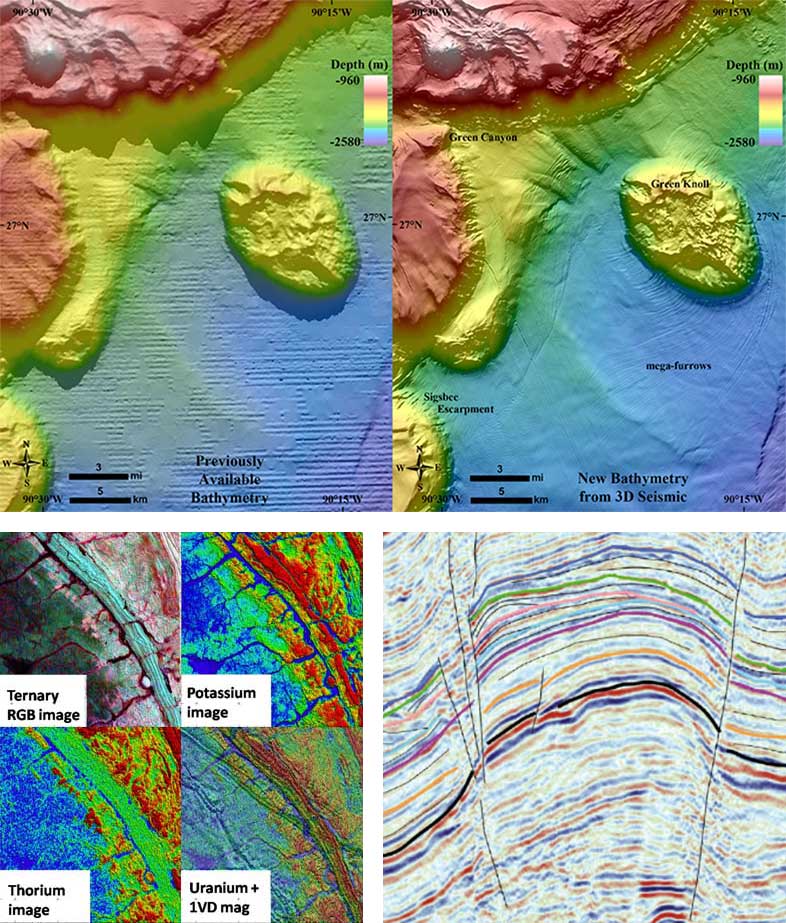
Since 2018 IDM Industries Ltd (IDM) has provided geological and geophysical services for the energy, power including renewables and mining sectors through partnerships with highly specialized industry leading technology partners. IDM can provide high quality 2D and 3D geophysical seismic acquisition and imaging services for conventional onshore land and offshore marine exploration and production as well as site surveys and seabed mapping for engineering and foundation stability studies ahead of wind farm development. Our airborne geophysical capabilities include gravity gradiometry and magnetics/radiometrics. IDM can also provide highly specialized LIDAR airborne services for detailed ground mapping for natural resources evaluation and monitoring including for studying the effects of climate variations. IDM is currently supporting one of its partners in a major geophysical seismic project for the Ministry of Petroleum, Energy and Mines in Mauritania and has a partnership with a major service provider in Qatar.
Seismic Services
- 2D and 3D seismic imaging
- Advanced 2D and 3D seismic imaging
- Integrated reservoir characterizations
- Petrophysical well log analysis with multi-mineral analysis
- High Frequency Processing
- High tech 3D survey merging, ideal for mixed vintage data with varying parameters
Airborne Services
- Airborne Gravity Gradiometry
- Airborne Magnetics and Radiometrics
Specialized Services
- Seabed mapping and site surveys including for wind farm development
- Airborne LIDAR for ground surveys and environmental studies
Key Technology and Operating Partners